This year my family is utilizing My Father’s World for the bulk of our curriculum. So far, we absolutely love it! This curriculum is offered in “cycles,” in which all children in 2nd through 8th grade can learn together during Bible, geography, history, and science. While middle schoolers have a bit of extra work each day as well, this curriculum is wonderful for those of us with large families! This year I have a 3rd grader, 6th grader, and 8th grader working together. We are completing a year of Exploring Countries and Cultures, and I am sharing a hands-on mapping activity that gave my kiddos a better understanding as to how a round globe can be depicted as a flat map.
Hands on Mapping Activity:
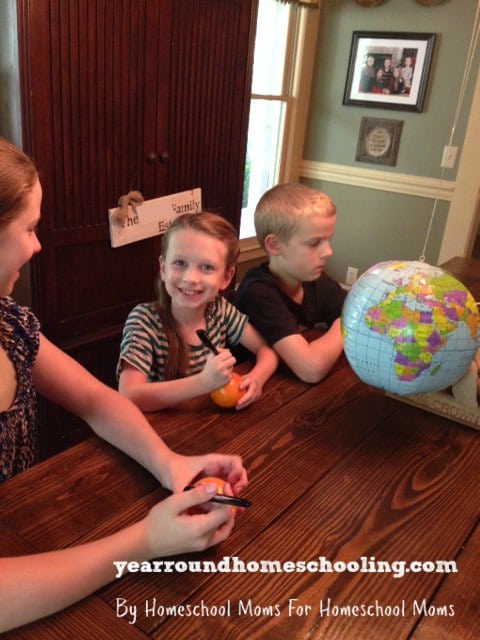
Right now we are using an inflatable globe in our homeschool, which is very cost efficient. These can be picked up online or in your local school supply store for around $6.00! I also bought a mandarin orange and a permanent marker for each child to be used during this activity. A thin-skinned ball could possibly work as well…that way your child can keep the “map” that they made.
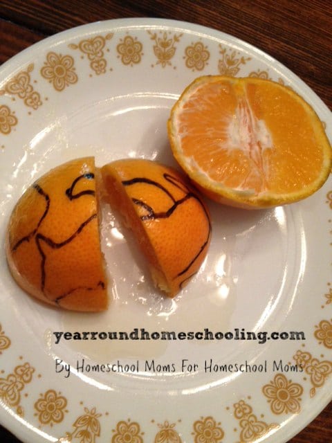
First of all, my children studied the globe, and then drew the continents as best as they could on their orange. (On a side note, we used Dollar Store permanent markers. These bled, and I would recommend using a Sharpie instead.)
Next, we cut the oranges into fourths, and peeled them.
Lastly, we flattened the orange peels as best as we could, and lined them up to make a map!
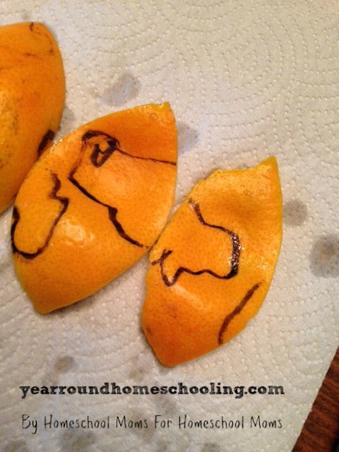
While completing this activity, my children were able to visualize the “stretching” that must happen on a flat map near the North and South Pole. More ocean space is added to flat maps, and continents/countries (such as Antarctica and Greenland) are stretched and appear larger than they actually are to compensate for the inevitable distortion taking place near the poles.
My children really enjoyed completing this relatively simple activity. Simple hands-on activities are wonderful, aren’t they? How have you studied mapping with your children?
You’ll find lots of fun ways to teach your children about geography by following our Pinterest board below.
Follow Misty Leask’s board Homeschool: Geography on Pinterest.
